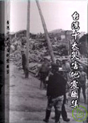
Disastrous shocks
In this atlas, we collect 448 photos and pictures which was taken from top 10 disastrous earthquakes in Taiwan during 1898 ~ 1997 when we have had monitoring system. And, top 10 disastrous earthquake are:
| 1904/11/06 | 1906/03/17 | 1916/08/28 | 1935/04/21 | 1941/12/17 |
|---|---|---|---|---|
| Douliou Earthquake | Meishan Earthquake | Nantou Earthquakes series | Hsinchu – Taichung Earthquake | Chungpu Earthquake |
| 1946/12/05 | 1951/10/22 | 1959/08/15 | 1964/01/18 | 1986/11/15 |
| Shinhua Earthquake | Rift Valley Earthquakes series | Hengchuen Earthquake | Baihe Earthquake | Hualien Earthquake |

Taiwan is in circum-Pacific seismic belt, has frequent earthquakes, and loses lots of lives and fortunes. To understand history and features on earthquake, we try collecting and arranging the photos and materials to build a data base to be a basic reference for another searches.
This atlas was sponsored by Central Weather Bureau (no. CWB87-2E-16) and Institute of Earth Sciences, Academia Sinica. It has 300 pages, and it is printed on coated paper. If you want to buy one please call services unit,
Central Weather Bureau TEL:23491102 and services unit,
Earthquake Forecasting center TEL:23491341
| No | Name of earthquake | Date/time (120oE) |
Position of Epicenter | Focal depth (Kilometer) |
Magnitude (ML) |
|
|---|---|---|---|---|---|---|
| North latitude(N) | East longitude(E) | |||||
| 1 | Douliou Earthquake | 1904/11/06 04:25 |
120.250 | 7.0 | 6.1 | |
| 2 | Meishan Earthquake | 1906/03/17 06:43 |
23.550 | 120.450 | 6.0 | 7.1 |
| 3 | Nantou Earthquakes series | 1916/08/28 15:27 |
24.000 | 121.025 | 45.0 | 6.8 |
| 1916/11/15 06:31 |
24.100 | 120.875 | 3.0 | 6.2 | ||
| 1917/01/05 00:55 |
24.000 | 120.975 | 很淺 | 6.2 | ||
| 1917/01/07 02:08 |
23.950 | 120.975 | 很淺 | 5.5 | ||
| 4 | Hsinchu – Taichung Earthquake | 1935/04/21 06:02 |
24.350 | 120.817 | 5.0 | 7.1 |
| 5 | Chungpu Earthquake | 1941/12/17 03:19 |
23.400 | 120.475 | 12.0 | 7.1 |
| 6 | Shinhua Earthquake | 1946/12/05 06:47 |
23.070 | 120.330 | 5.0 | 6.1 |
| 7 | Rift Valley Earthquakes series | 1951/10/22 05:34 |
23.875 | 121.725 | 4.0 | 7.3 |
| 1951/10/22 11:29 |
24.075 | 121.725 | 1.0 | 7.1 | ||
| 1951/10/22 13:43 |
23.825 | 121.950 | 18.0 | 7.1 | ||
| 1951/11/25 02:47 |
23.100 | 121.225 | 16.0 | 6.1 | ||
| 1951/11/25 02:50 |
23.275 | 121.350 | 36.0 | 7.3 | ||
| 8 | Hengchuen Earthquake | 1959/08/15 16:57 |
21.700 | 121.300 | 20.0 | 7.1 |
| 9 | Baihe Earthquake | 1964/01/18 20:04 |
23.200 | 120.600 | 18.0 | 6.3 |
| 10 | Hualien Earthquake | 1986/11/15 05:20 |
23.992 | 121.833 | 15.0 | 6.8 |
| The positions of epicenter are cited by results of researches and reports, for example: Douliou Earthquake in 1904 was cited by Y. T. Yeh (1997), Meishan Earthquake in 1916 was cited by S. N. Tzeng (1997), Hsinchu – Taichung Earthquakes series was cited by Taipei Seismic station (1936) and M. T. Shiu (1989), Chungpu Earthquake in 1941 was cited by S. N. Tzeng (1996), Shinhua Earthquake in 1946 was cited by S. N. Tzeng (1995) and Y. T. Yeh (1989), Rifts Valley Earthquakes Series in was cited by Cheng et al.(1996) and S. N. Tzeng (1997), Hengchuen Earthquake in 1959 and Baihe Earthquakes was cited by M. T. Shiu (1980) and S. N. Tzeng & Y. T. Yeh (1989), Hualien Earthquake in 1986was cited by TTSN. Magnitudes of all earthquakes are change from Y. T. Yeh (1995) to Richter scale (Near-seismic Scale). | ||||||
-
- Earthquake Information
- Disastrous shocks
- Earthquake Report
- Earthquake Factsheets
-
- Tsunami
- Tsunami Information
-
- Disaster Prevention
- Precautions for Earthquake
- Precautions for Tsunami
- FAQ for Earthquake
-
- Observation network
- Observation network
- monitoring station searching

